-40%
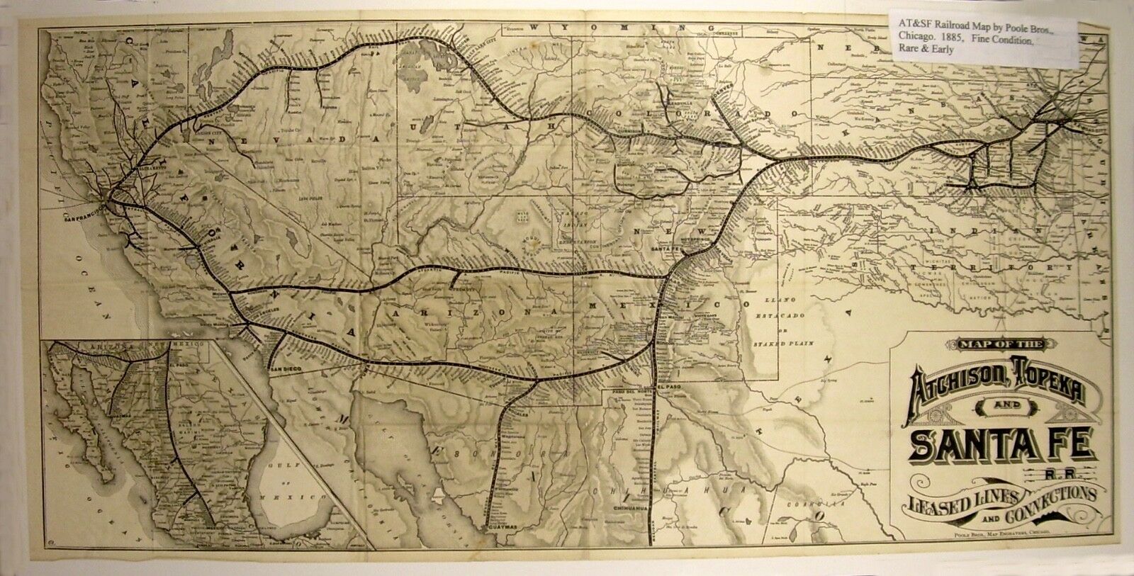
1884 Railroad MAP» Atchison, Topeka and Santa Fe» by POOLE Bros»16½ x 33½ « FINE
$ 343.2
- Description
- Size Guide
Description
* * B I D W I T H C O N F I D E N C E * *~~~ ALWAYS GUARANTEED ~~~
~~~~~~~~~~~~~~~~~~~~ O O O ~~~~~~~~~~~~~~~~~~~~
~ DESCRIPTION ~
Map of the Atchison, Topeka and Santa Fe Railroad
With ‘Leased Lines and Connections’
Original Map of the Atchison, Topeka and Santa Fe RR with ‘Leased Lines and Connections’
… from Kansas City across the Western United States and into Mexico.
By Poole Bros., 1884. A map in fine condition … from The Santa Fe Route time table,
with graphics of Mexico on the front and back. Rare!
SIZE = 16 ½” x 33 ½”
CONDITION = FINE
~~~ O ~~~
*** FREE SHIPPING TO US ADDRESSES! ***
INSURANCE
- Optional - please inquire.
MEDIA RATE
- Tracking information included.
NO INTERNATIONAL SHIPPING FOR THIS ITEM
Please eMail for shipping quote for Multiple Items.
FOR OPTIONAL SHIPPING METHODS, PLEASE INQUIRE.
~~~ O ~~~
*** PAYMENT OPTIONS ***
We are accepting payment via
PayPal
only.
Payment to be received within 5 days, please.
Please see our listings at
HOLLINGSWORTH'S PRINTS, MAPS, BOOKS
eBay Store
as you may find other items of interest.
~~~ O ~~~
